gold rush trail
5A地址: 暂无
开放时间: 暂无


景点点评
The Matthew River Road is a good 2 wheel drive road. Watch your speed though, the rocks can be sharp and damaging to your tires. Be sure your spare tire is road worthy, just in case. The route is well marked with Gold Rush Trail signs, which also indicate the point of interest (always worth a stop) and the distance to the next point. We did the drive from Likely to Wells. The first third has its scenery hidden by overgrowth, but be patient, the road way does open up to beautiful mountain vistas, rivers, waterfalls and lakes. It was well worth the drive. Always pack extra water. The recommended 3 hours is only if you don't stop. If you enjoy a walk now and then, and taking some photo's allow yourself an extra hour.
The Gold Rush Circle Road is a 3 hours trip from Barkerville to Likely, BC through absolutely stunning country. You don't need a 4X4 but it makes it easier and there are some spots where a low car could be damaged. There is very little traffic so take a decent map, water, food and let someone know you're using the road. If you learned anything at Barkerville this road will really drive home the history. It's all pretty breathtaking but a little remote and if you break down you might be there for some time....we met two cars in three hours. The road is pretty rough in places and there was a lot of evidence of bears on the road and we saw one at the side of the road. Fabulous scenery and worth it.
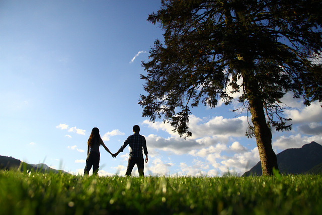
Two kinds of people on the planet - those that have experienced the Barkerville/Wells/Bowron Lakes area and those that should. No matter what your background age or income, this value packed region will dig it's way into your heart.
The professional restaurant staff were dress like old days, and the wood stove and tables and building are all old and authentic.
Its quite fun to travel back in time and enjoy this gold rush trail and the stories along the way. There is a real pride in the history of the area when you stop and talk to folks. We were surprised by the terrain, thought we'd see more wildlife, but the drive was beautiful up from Vancouver.
Very attractive tourist destination! Don't miss this great road trip on your way north through the Cariboo.
This was a great way to spend a day. We had great weather and loved the history and mostly the surroundings.
I am an avid backroader, own all the maps and prefer them to highways, it says this can be done in a car , you could you just have to go slower, there is one resort the comet creek opens in late June early july and then in the fall they open there hunting camp further down the road. the views and numerous falls our worth it. It is bear country so be bear aware. This will take you 2 to 2.5 hours so be prepared. It took me 2 but I own a Jeep so I can handle a little bumping around plus I stopped at Comet Creek resort and Matthew and Ghost Falls Recreation Site which had campers there , the site only has 2 sites which if you planning to camp is good to remember because the cariboo river recreation site is quite awhile back. The next site is the Lady something on Quesnel Lake which is also quite aways ahead. I do recommend following the signs and tracking with milage in your vehicle, buying the backroads mapbook and stopping in at the visitiors center to see how the road is . Happy trails.
As you go along the roadway from Keithley Creek up to Barkerville via the Likely road, you will come to many major attraction through out the trip. The road is very carefully marked, and you can follow all of the signs and you will end up where you are supposed to. The map that they give you is very accurately documented on the roads and areas that you go along.Some interesting sites, are the Matthew Valley floor, and also the really tall mountains that you see to the right when you're coming up form Likely. I believe that they are in the Cariboo Mountain Range. We were unfortunate, in the fact that we were not able to see these mountains the tops of them anyhow, due to the amount of cloudiness that we were having that morning. But in most cases you would want to go slow in this area as there are some really good pictures that you would be able to take.Cariboo River Falls -- this is a good site. But the road that it mentions to take is this narrow lane to the falls. You should have a fairly good vehicle to make this journey, as the road tends to get very muddy from what we could see, with fairly big potholes.Cameron Ridge is a good hiking trail at location 5. You should be a good hiker in good condition to be able to hike this ridge, as it is one of those more complicated hikes. At site 7, you will come across the Ghost Falls. This is an absolute must see. There is a bridge that goes over the falls, and you can see the top half roaring, and then the bottom half is on the other side of the bridge. If you continue more along the road, you will come across the campsite. You should go up to the campsite, which is nestled within the Cariboo Mountain Park. There is a small short hike that you can take at 50-100 m away from the parking area, and it goes down a bit of a hill and then there is a marshy area that has wooden logs, that you should watch your footing on. The lake is very green. It is very picturesque. Be sure however, to make a lot of noise, and also make sure that you're hiking with someone, as this is Bear Country as well as cougar country, so you do NOT want to scare either of these animals. After you have made a detour to these gorgeous falls, you can transverse and go back to the top where the site number is and carry on.There is a restaurant and a lodge further up the road, but from what we saw, it looked fairly closed, and not running. The best thing is to talk either with the tourist bureau at the historic town of Barkerville, or at Cedar Point Provincial Park in Likely to get some more information about whether this area will ever open up for business again. It is possible that is only open during some times of the year, and not during other times of the year.The next major stop of interest is you will go into the Cariboo River Park. There is a small road that leads from around the bridge that goes over the Cariboo River. In this area, near the entrance, is ideal fishing grounds, but you need to be really careful for wildlife that may be in the area. We saw a number of very fresh animal prints, and you need to keep that in mind when you are looking around for fishing, or other type of recreational activities. With that in mind, we didn't stay there too long before moving on, as we didn't want to be there, incase the animals decided like they would want to return to get back to that spot.The remaining stretches that lead to Barkerville is quite long, with not many highlights until you get to the end. We go through several of kilometers before we get to the intersection of where the road meets up with the Bowron Lakes. At this point, we see a sign introducing us to the park. We were told from the sign that we would have to go 28 km if we wanted to see the park, but we chose not to. We then stopped by the historic town of Barkerville.This back road is a seasonal road and dependant on the weather conditions, and the seasonal variations that there are out there. Sometimes after heavy rain, it can get quite muddy, and also very wet. Keep in mind that these are shared roads. If you see another vehicle, or if you see an ATV, then you need to give them plenty of room as well. A lot of the ATVers you will find with the company of a dog.This road was really worth while, and we hope that we will be able to do it again at some point possibly. This road has many recreational properties to it: swimming, hiking, wildlife viewing, boating etc. and much more. If you want to learn more about this exciting trip, please feel free to contact Cedar Point Park, or Barkerville for more information, or you can contact me as well.
Der gold rush trail ist eine unbefestigte Nebenstrasse von Barkerville nach Likely. Je nach Wetterzustand kann sich der Zustand der Strasse ändern, daher sollte man sich vorab gut informieren (z.B. in Barkerville oder Wells).Die Strasse wird nur sehr selten befahren und das Fahrzeug sollte sich in einem guten Zustand befinden. Bei unseren Fahrten auf dieser Strecke haben wir immer Bären gesehen.Wer genüend Zeeit hat, kann die Fahrt an einigen Stellen unterbrechen und einen Abstecher zum ghost Lake machen oder eine Wanderung auf den cameron Ridge trails.